Educational Map

An Interactive Map presenting illustrated information about the organization of an institution. The map is accessible via a WordPress site and is intended for visitors, primarily younger audiences. The interface must be simple and ergonomic on mobile devices, and a second map needs to be integrated for a detailed zoom-in view of the location.
Key points

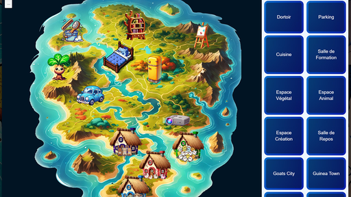
General Map
The general map is a standard map that allows users to view all points of interest around the institution. It highlights locations with textual descriptions.
Zoom Map
The zoom map provides a detailed view of a specific point of interest. It is accessible via a button on the general map.
Challenges
Designing the interface was challenging due to the two overlapping maps sharing the same space.
Ensuring usability on both mobile and large screens required special adaptations due to the amount of textual information to display.
Importing the map via WordPress required mastering the plugin system and managing assets (JavaScript, CSS, images, etc.) to maintain optimal loading speed.